Scroll for prep

Please wait…
This video is having trouble loading. You may have lost your Internet connection.
Step 1: Click to Reload this page
Step 2: Click to
Try our other video player
Step 3: contact support if trouble persists.
Or,
dismiss this message.
CONVERSEMOS:
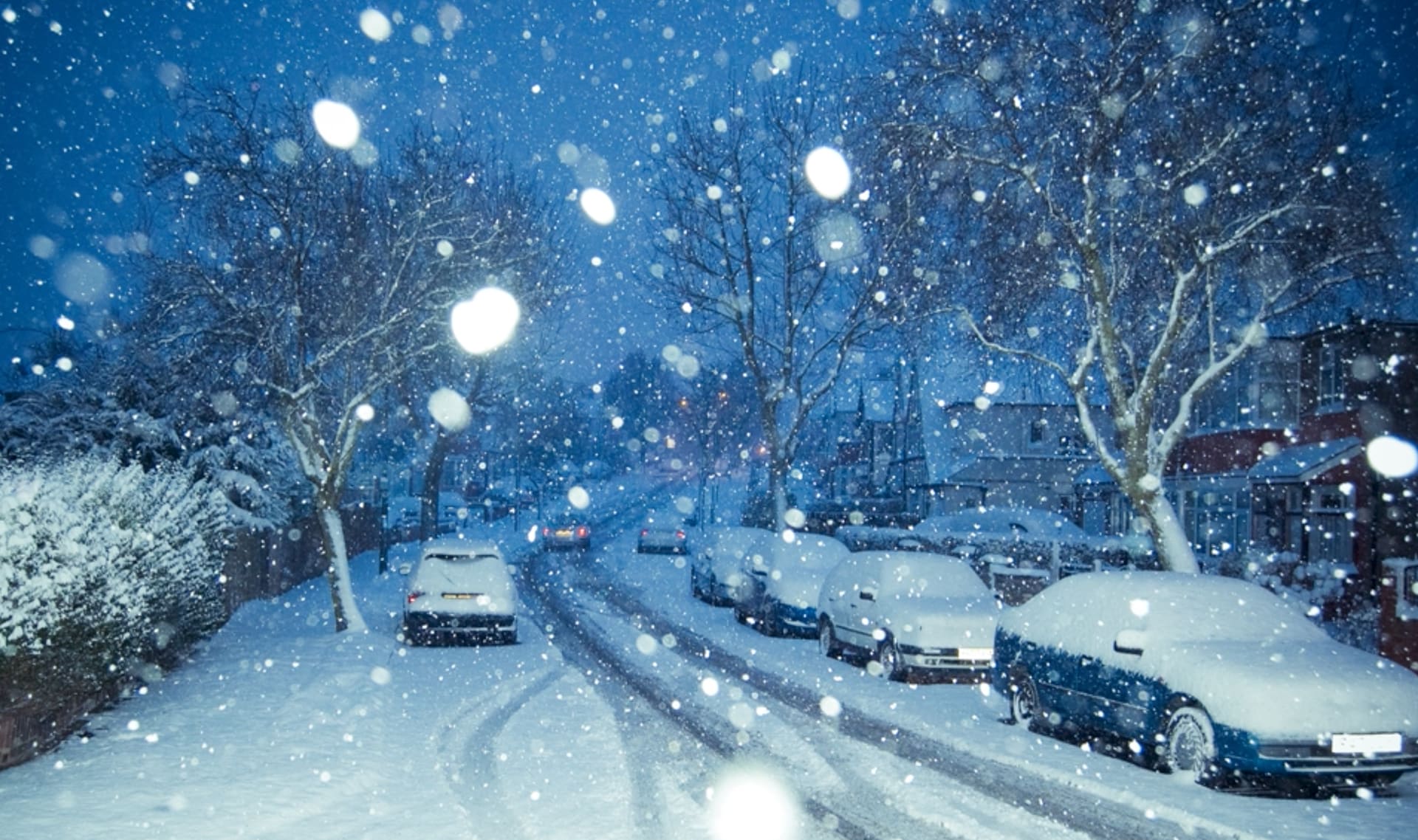
¿Cómo es el clima donde vives? ¿Se parece más a dónde creció Doug o a dónde creció Shelly? ¿O es completamente diferente a los dos?
Please wait…
This video is having trouble loading. You may have lost your Internet connection.
Step 1: Click to Reload this page
Step 2: Click to
Try our other video player
Step 3: contact support if trouble persists.
Or,
dismiss this message.
Please wait…
This video is having trouble loading. You may have lost your Internet connection.
Step 1: Click to Reload this page
Step 2: Click to
Try our other video player
Step 3: contact support if trouble persists.
Or,
dismiss this message.
Paso
01/18
01/18
Encuentra un compañero o compañera con quien trabajar.
Please wait…
This video is having trouble loading. You may have lost your Internet connection.
Step 1: Click to Reload this page
Step 2: Click to
Try our other video player
Step 3: contact support if trouble persists.
Or,
dismiss this message.
Paso
02/18
02/18
Obtén estos útiles. Cada grupo necesita estas cosas.
Please wait…
This video is having trouble loading. You may have lost your Internet connection.
Step 1: Click to Reload this page
Step 2: Click to
Try our other video player
Step 3: contact support if trouble persists.
Or,
dismiss this message.
Paso
03/18
03/18
Colorea el decodificador climático. Usa el color azul para las
temperaturas frías. Usa el amarillo para las temperaturas cálidas.
Y usa el rojo para las temperaturas calientes.
temperaturas frías. Usa el amarillo para las temperaturas cálidas.
Y usa el rojo para las temperaturas calientes.
Please wait…
This video is having trouble loading. You may have lost your Internet connection.
Step 1: Click to Reload this page
Step 2: Click to
Try our other video player
Step 3: contact support if trouble persists.
Or,
dismiss this message.
Paso
04/18
04/18
Dibuja dos líneas entre el decodificador climático de arriba y el de
abajo. Usa una regla para conectar los puntos entre dos colores.
abajo. Usa una regla para conectar los puntos entre dos colores.
Please wait…
This video is having trouble loading. You may have lost your Internet connection.
Step 1: Click to Reload this page
Step 2: Click to
Try our other video player
Step 3: contact support if trouble persists.
Or,
dismiss this message.
Paso
05/18
05/18
Ejemplo: Mira el invierno en la Antártida. ¿De qué color es esa parte
del decodificador climático? Colorea el círculo usando ese color.
del decodificador climático? Colorea el círculo usando ese color.
Please wait…
This video is having trouble loading. You may have lost your Internet connection.
Step 1: Click to Reload this page
Step 2: Click to
Try our other video player
Step 3: contact support if trouble persists.
Or,
dismiss this message.
Paso
06/18
06/18
Ejemplo: Mira el verano en Antártida. ¿De qué color es esa parte
del decodificador climático? Colorea el círculo usando ese color.
del decodificador climático? Colorea el círculo usando ese color.
Please wait…
This video is having trouble loading. You may have lost your Internet connection.
Step 1: Click to Reload this page
Step 2: Click to
Try our other video player
Step 3: contact support if trouble persists.
Or,
dismiss this message.
Paso
07/18
07/18
Ahora haz lo mismo con los otros lugares. Para cada uno, colorea
el invierno y el verano del color indicado, usando el decodificador
climático.
el invierno y el verano del color indicado, usando el decodificador
climático.
Please wait…
This video is having trouble loading. You may have lost your Internet connection.
Step 1: Click to Reload this page
Step 2: Click to
Try our other video player
Step 3: contact support if trouble persists.
Or,
dismiss this message.
Paso
08/18
08/18
Checa tu trabajo con tu compañero o compañera. Corrijan
cualquier cosa en la que no estén de acuerdo.
cualquier cosa en la que no estén de acuerdo.
Please wait…
This video is having trouble loading. You may have lost your Internet connection.
Step 1: Click to Reload this page
Step 2: Click to
Try our other video player
Step 3: contact support if trouble persists.
Or,
dismiss this message.
Paso
09/18
09/18
Encuentra lugares donde el invierno y el verano son azules y
colorea el círculo que dice “clima” del mismo color. Luego, haz
lo mismo con los lugares donde el invierno y el verano son rojos.
colorea el círculo que dice “clima” del mismo color. Luego, haz
lo mismo con los lugares donde el invierno y el verano son rojos.
Please wait…
This video is having trouble loading. You may have lost your Internet connection.
Step 1: Click to Reload this page
Step 2: Click to
Try our other video player
Step 3: contact support if trouble persists.
Or,
dismiss this message.
Paso
10/18
10/18
Ahora busca donde los inviernos son azules (fríos) y los veranos
son rojos (calientes). Colorea el círculo del clima morado.
son rojos (calientes). Colorea el círculo del clima morado.
Please wait…
This video is having trouble loading. You may have lost your Internet connection.
Step 1: Click to Reload this page
Step 2: Click to
Try our other video player
Step 3: contact support if trouble persists.
Or,
dismiss this message.
Paso
11/18
11/18
Busca lugares donde los inviernos son amarillos (cálidos) y los
veranos son rojos (calientes). Colorea el círculo del clima de color
naranja.
veranos son rojos (calientes). Colorea el círculo del clima de color
naranja.
Please wait…
This video is having trouble loading. You may have lost your Internet connection.
Step 1: Click to Reload this page
Step 2: Click to
Try our other video player
Step 3: contact support if trouble persists.
Or,
dismiss this message.
Paso
12/18
12/18
Revisa tu trabajo con el de tu compañero o compañera. Corrijan
cualquier cosa en la que no estén de acuerdo.
cualquier cosa en la que no estén de acuerdo.
Please wait…
This video is having trouble loading. You may have lost your Internet connection.
Step 1: Click to Reload this page
Step 2: Click to
Try our other video player
Step 3: contact support if trouble persists.
Or,
dismiss this message.
Paso
13/18
13/18
Trabaja con tu compañero o compañera para determinar de qué
color colorear la leyenda en tu mapa.
color colorear la leyenda en tu mapa.
Please wait…
This video is having trouble loading. You may have lost your Internet connection.
Step 1: Click to Reload this page
Step 2: Click to
Try our other video player
Step 3: contact support if trouble persists.
Or,
dismiss this message.
Paso
14/18
14/18
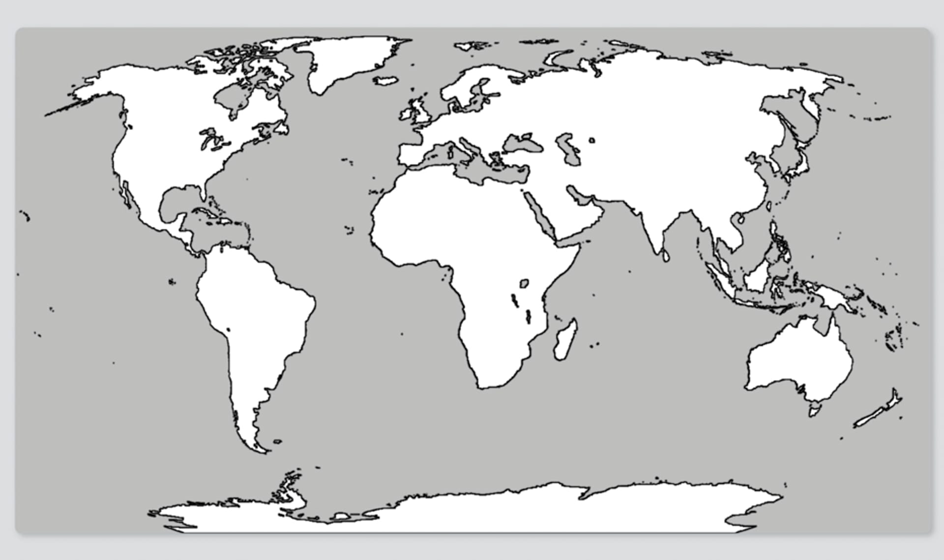
Encuentra cada lugar en el mapa y colorea el área que lo rodea
del color del clima de ese lugar. No te salgas de la línea punteada.
del color del clima de ese lugar. No te salgas de la línea punteada.
Please wait…
This video is having trouble loading. You may have lost your Internet connection.
Step 1: Click to Reload this page
Step 2: Click to
Try our other video player
Step 3: contact support if trouble persists.
Or,
dismiss this message.
Paso
15/18
15/18
Ahora, tu maestro o maestra escogerá tres mapas que estén listos
y los juntará de esta forma.
y los juntará de esta forma.
Please wait…
This video is having trouble loading. You may have lost your Internet connection.
Step 1: Click to Reload this page
Step 2: Click to
Try our other video player
Step 3: contact support if trouble persists.
Or,
dismiss this message.
Paso
16/18
16/18
En tu clase, platiquen sobre sus respuestas a estas preguntas.
Please wait…
This video is having trouble loading. You may have lost your Internet connection.
Step 1: Click to Reload this page
Step 2: Click to
Try our other video player
Step 3: contact support if trouble persists.
Or,
dismiss this message.
Paso
17/18
17/18
En tu clase, platiquen sobre sus respuestas a esta pregunta.
Please wait…
This video is having trouble loading. You may have lost your Internet connection.
Step 1: Click to Reload this page
Step 2: Click to
Try our other video player
Step 3: contact support if trouble persists.
Or,
dismiss this message.
Paso
18/18
18/18
En tu clase, platiquen sobre sus respuestas a esta pregunta.
Please wait…
This video is having trouble loading. You may have lost your Internet connection.
Step 1: Click to Reload this page
Step 2: Click to
Try our other video player
Step 3: contact support if trouble persists.
Or,
dismiss this message.
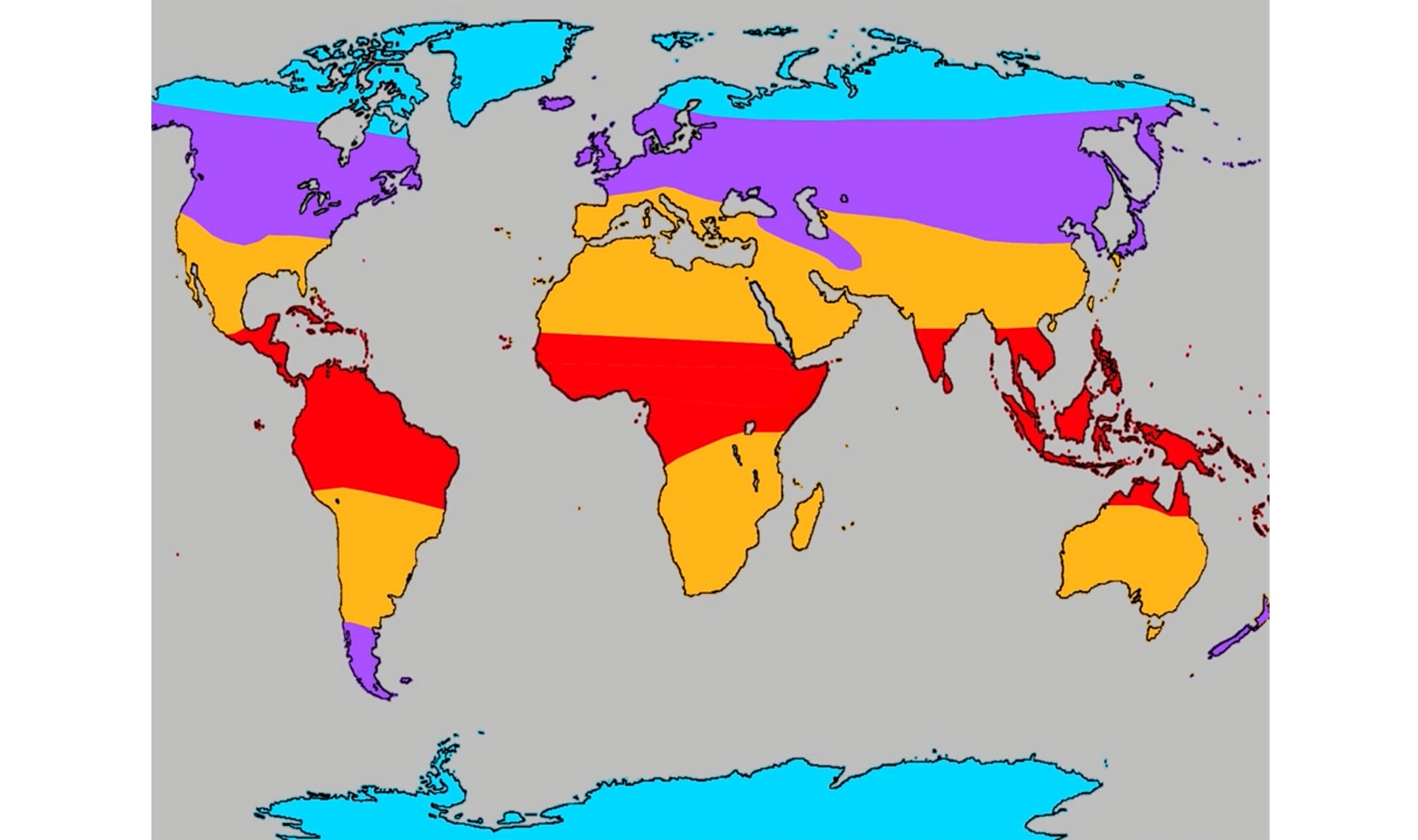
CONVERSEMOS:
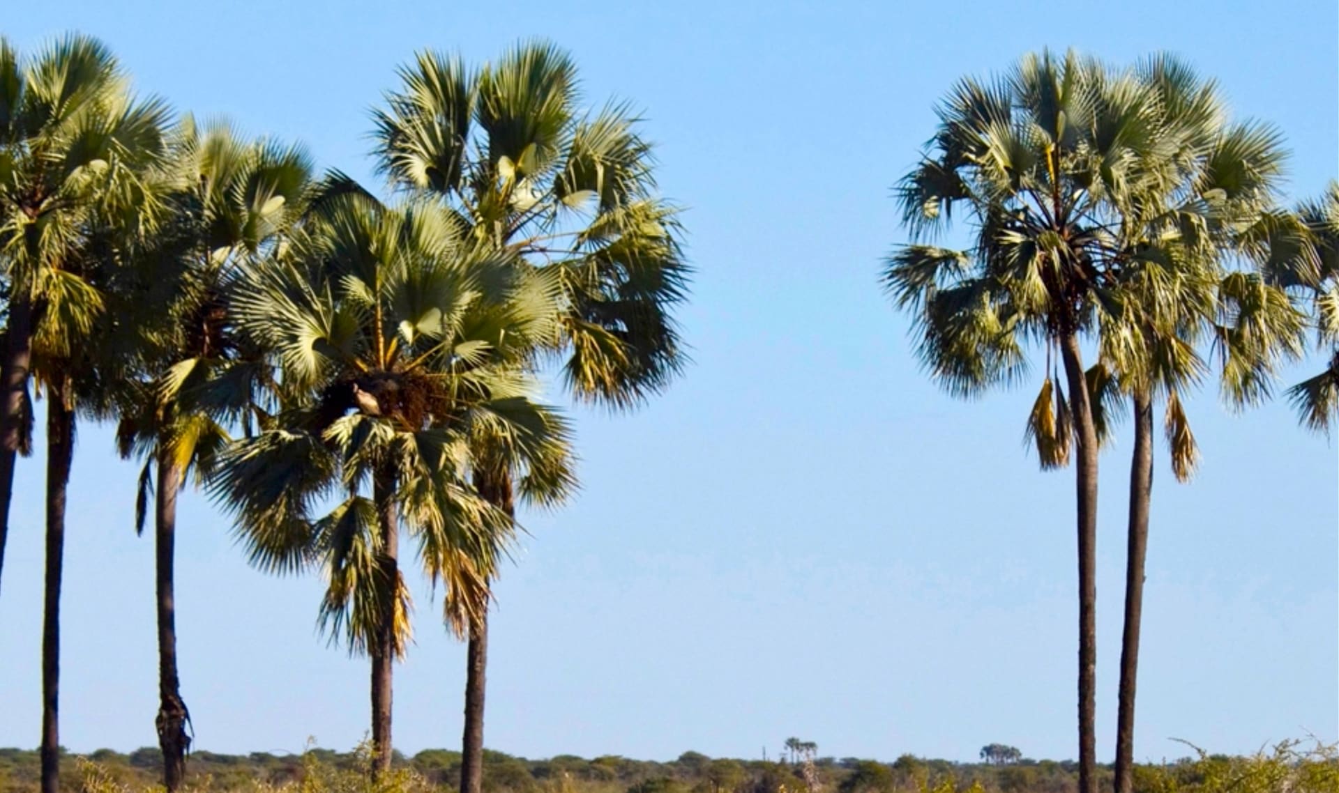
¿Qué tipo de clima, de plantas, y de animales crees que las zonas naranjas y moradas tienen? ¿Por qué crees eso?
Please wait…
This video is having trouble loading. You may have lost your Internet connection.
Step 1: Click to Reload this page
Step 2: Click to
Try our other video player
Step 3: contact support if trouble persists.
Or,
dismiss this message.
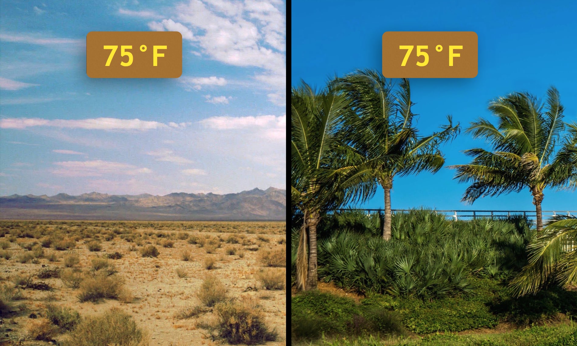
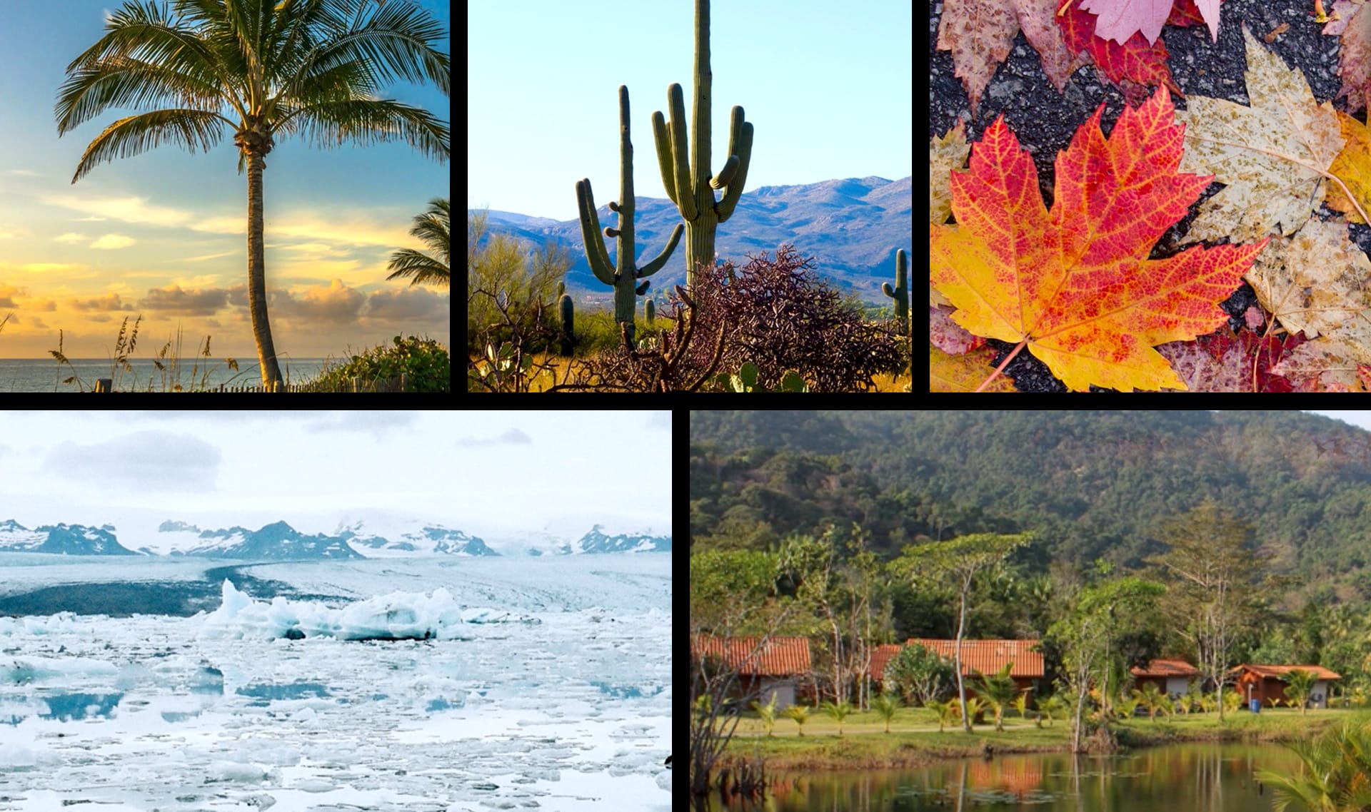
CONVERSEMOS: Estos dos lugares tienen las mismas temperaturas durante el año… entonces, ¿por qué se ven tan diferentes?
¿Tienes alguna idea?
Please wait…
This video is having trouble loading. You may have lost your Internet connection.
Step 1: Click to Reload this page
Step 2: Click to
Try our other video player
Step 3: contact support if trouble persists.
Or,
dismiss this message.
CONVERSEMOS:
(1) ¿En cuáles de estas zonas climáticas has estado?
(2) ¿Y cuáles te gustaría visitar?

Please wait…
This video is having trouble loading. You may have lost your Internet connection.
Step 1: Click to Reload this page
Step 2: Click to
Try our other video player
Step 3: contact support if trouble persists.
Or,
dismiss this message.
estación
1 de 13
una parte del año que tiene un clima particular y que se repite cada año
verano
2 de 13
una de las cuatro estaciones del año, la temporada más calurosa en muchos lugares
invierno
3 de 13
una de las cuatro estaciones del año, la temporada más fría en muchos lugares
mapa
4 de 13
un dibujo de un lugar que te muestra en dónde está cada cosa
clima
5 de 13
las condiciones del tiempo en un área que son similares año tras año
patrón
6 de 13
algo que sucede una y otra y otra vez de manera predecible
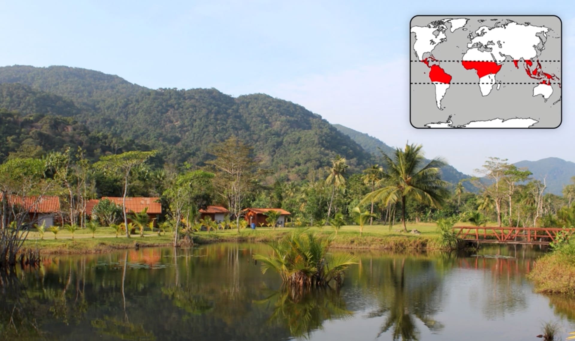
clima tropical
7 de 13
clima que es cálido todo el año y que recibe mucha lluvia
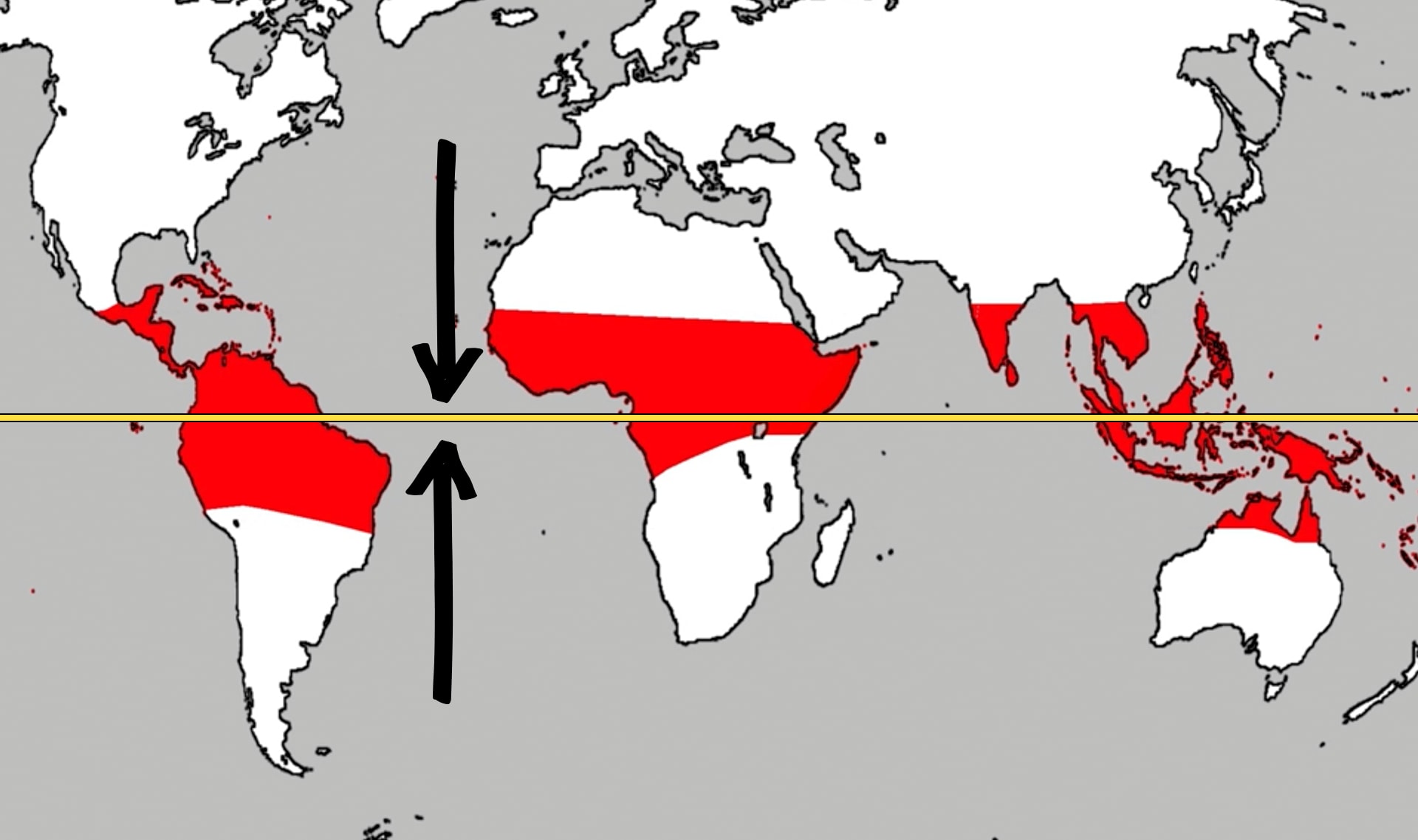
ecuador
8 de 13
la línea imaginaria que dibujamos en la mitad de la tierra; ahí se encuentran los climas tropicales
clima templado
9 de 13
clima que es cálido durante el invierno y caliente en el verano
clima continental
10 de 13
clima que es frío en invierno y caliente durante el verano
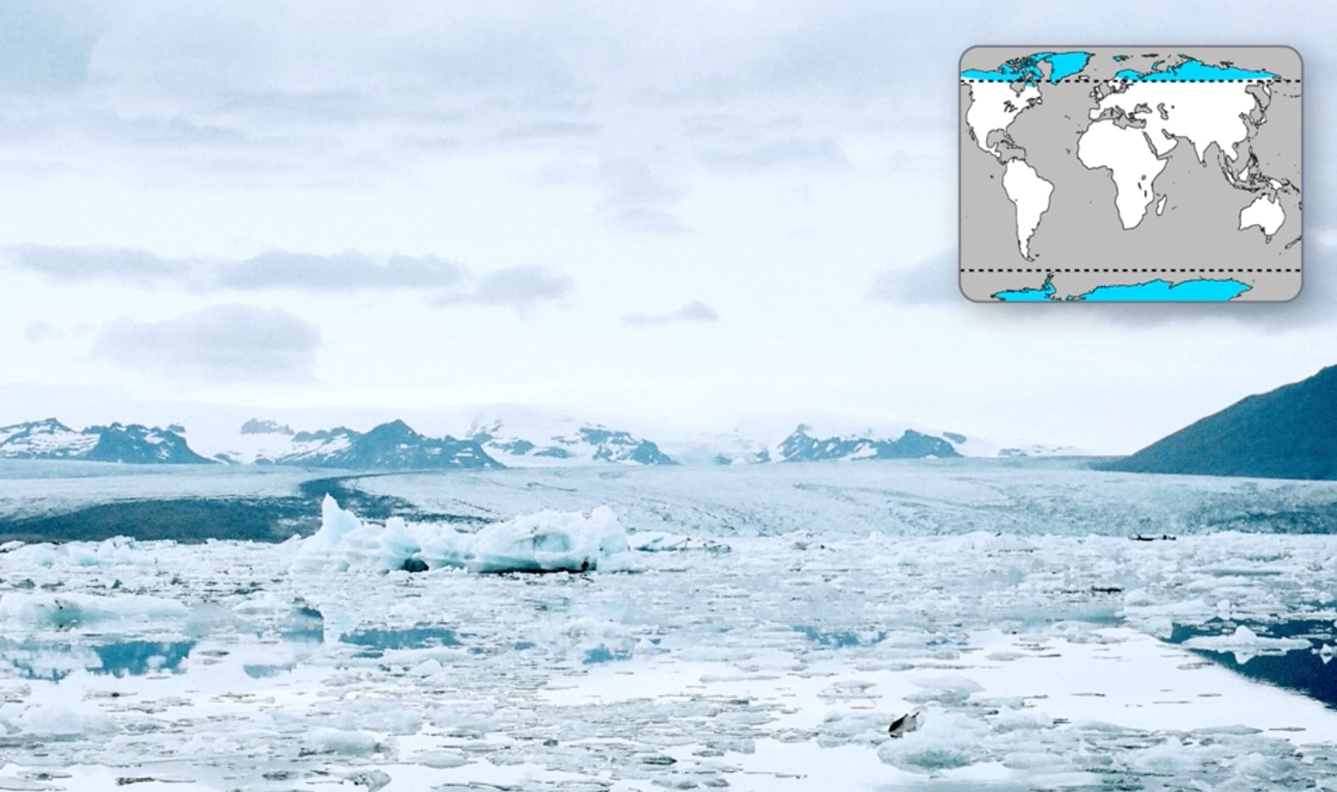
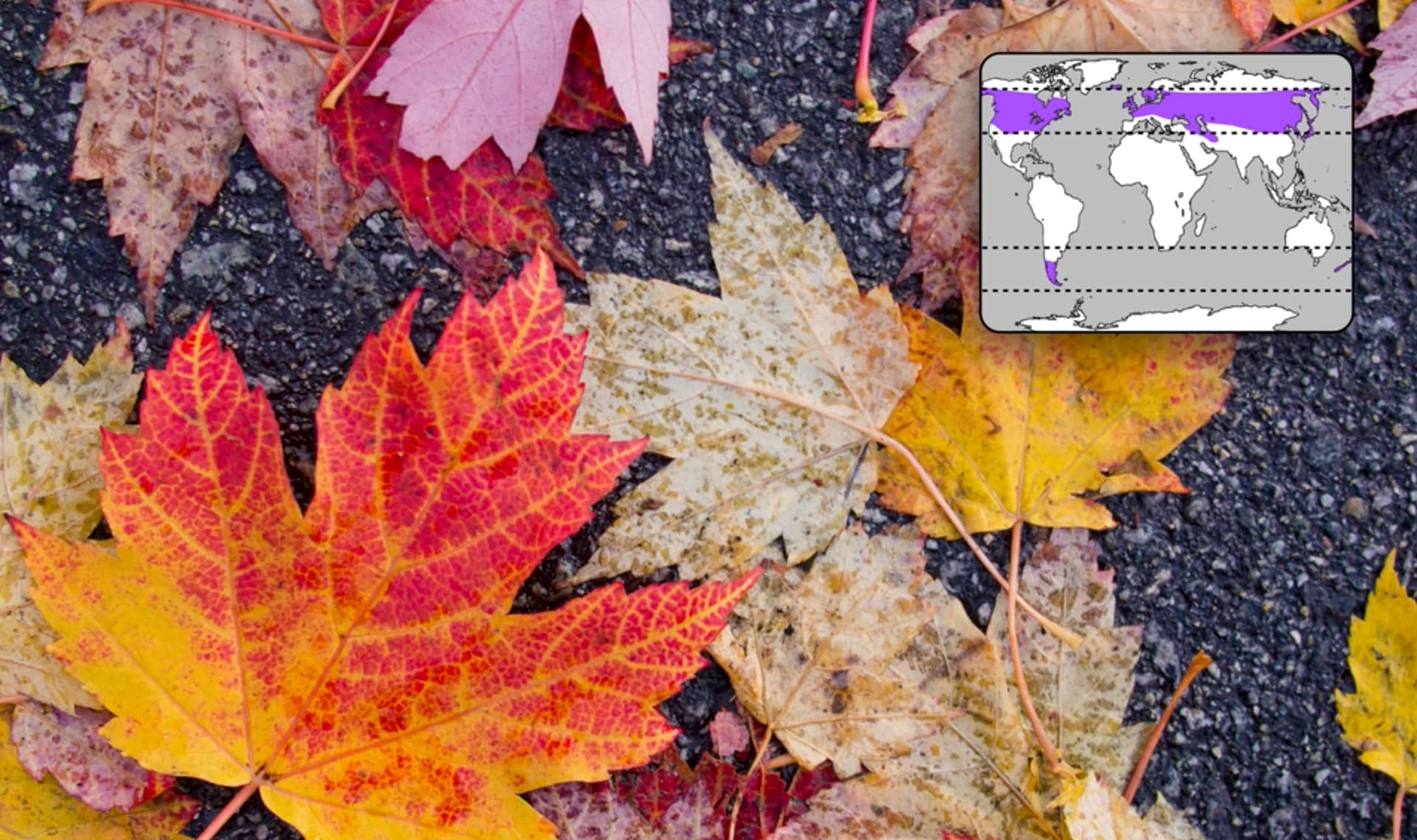
clima polar
11 de 13
clima frío durante todo el año
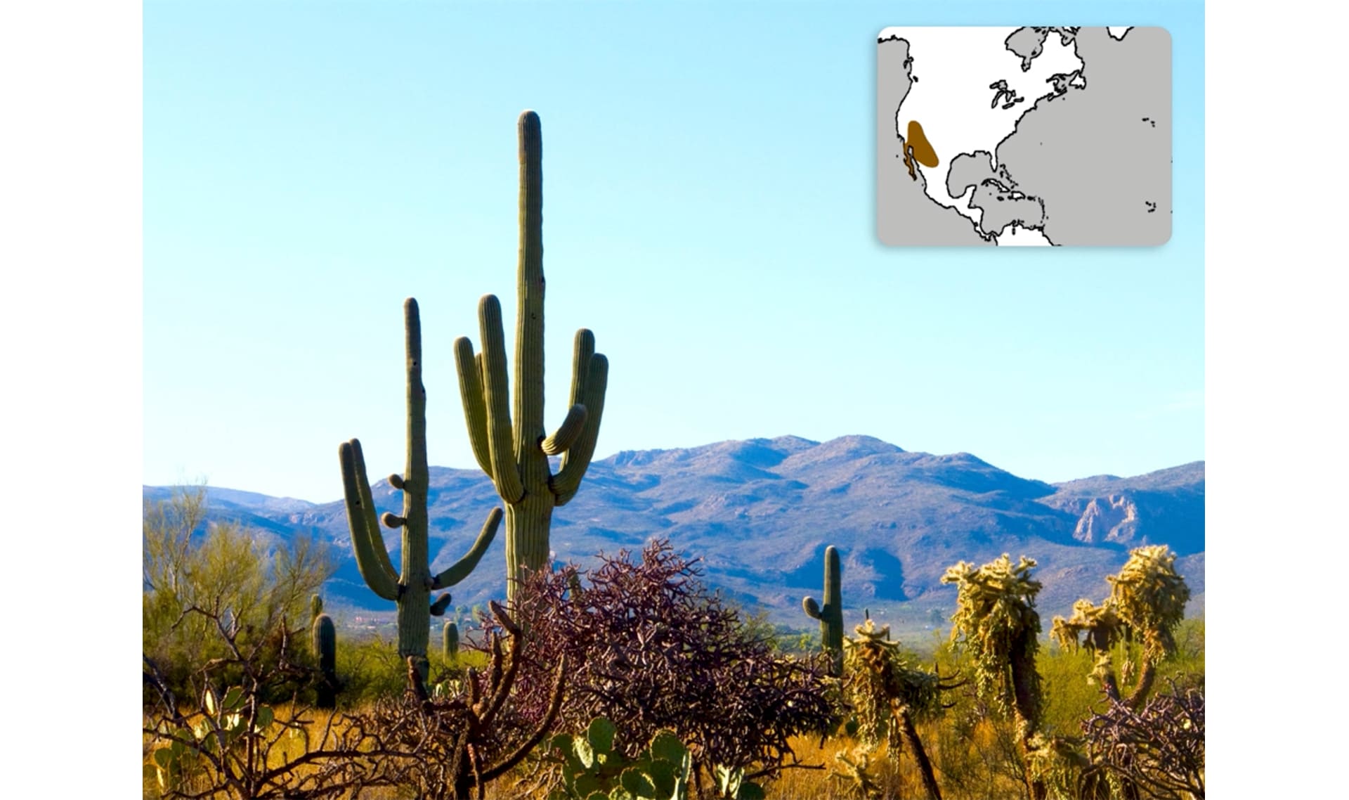
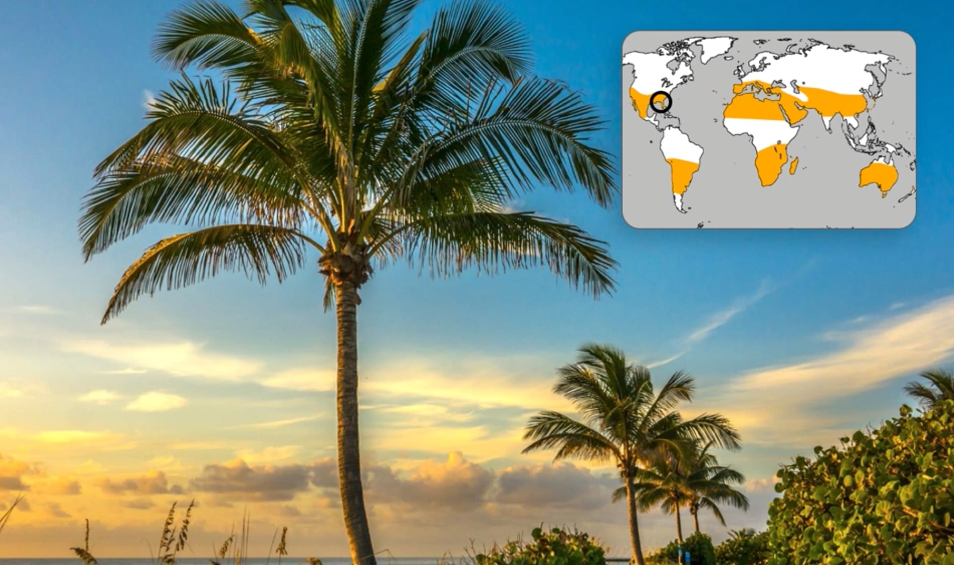
clima seco (clima desértico)
12 de 13
clima con muy poca lluvia
Please wait…
This video is having trouble loading. You may have lost your Internet connection.
Step 1: Click to Reload this page
Step 2: Click to
Try our other video player
Step 3: contact support if trouble persists.
Or,
dismiss this message.
evaporación
13 de 13
the process of a liquid changing to a gas
🎉
That’s it for this lesson! How did it go?
Sign up now for more great lessons!